ICARUS Decision Support System
Sep 2019 - Oct 2021
Upcom
The ICARUS Decision Support System is a software solution based on modular architecture that combines several different technologies in the fields of IoT, SQL, NoSQL and spatial databases, data processing and WebGIS.
The ICARUS Decision Support System represents a comprehensive software solution for urban impact assessment, specifically designed to support air quality and climate change governance in European Union Member States.
Project Context
ICARUS was a European research and innovation project funded by Horizon 2020 (Grant Agreement No 690105) that developed integrated tools and strategies for urban impact assessment in support of air quality and climate change governance in EU Member States. The project aimed to design and implement appropriate abatement strategies to improve air quality and reduce carbon footprint in European cities.
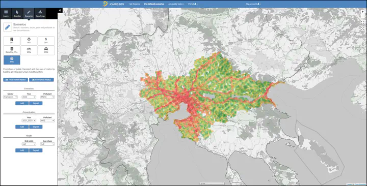
System Architecture
The DSS is built on a modular architecture that combines several cutting-edge technologies:
Web Interface Application
- Spring Boot Framework: Java-based backend development
- Thymeleaf Template Engine: Server-side rendering
- Apache Tomcat 7.0.67: Application server
- Nginx Server: High-performance web server
- Java 1.8: Runtime environment
GIS Server
- GeoServer 2.14.2: Open-source Java-based geospatial server
- Web Map Service (WMS): OGC standard implementation
- Web Feature Service (WFS): Geospatial data sharing
- High-quality map rendering: Handling hundreds to thousands of map layers
Management Server
- Microservices Architecture: Scalable service deployment
- Docker Containerization: Pre-configured images for each service
- Cloud Computing: Distributed deployment capabilities
- High-Performance Computing: Processing intensive atmospheric models
Database Management Systems
- PostgreSQL: Primary relational database for structured data
- CouchBase NoSQL: Distributed data from IoT devices and wearables
- Spatial Databases: Geospatial data storage and processing
Data Processing Capabilities
The DSS processes significant amounts of heterogeneous data:
- Geospatial Data: European-wide coverage with high-resolution city data
- Time Series: IoT and wearable device measurements
- Atmospheric Models: WRF-CHEM and CAMx simulation results
- Policy Data: Urban and regional policy analysis
- Environmental Monitoring: Air quality and climate data
Key Features
- Multi-Scale Analysis: Different spatial and temporal scales
- Regulatory Context: Specific regulatory framework consideration
- Interactive Platform: Web-based stakeholder interface
- Decision Support: Policy evaluation and recommendation tools
- Real-time Processing: IoT data integration and analysis
Technical Deployment
The system components are deployed across different environments:
- Virtual Machines: Physical and cloud-based hosting
- Load Balancing: High-request handling without consistency issues
- Scalable Architecture: Layer independence for easy scaling
- Transferable Deployment: Configurable for different environments
Impact and Applications
The ICARUS DSS has been successfully deployed for:
- Urban impact assessment across European cities
- Air quality and climate change governance support
- Policy analysis and recommendation generation
- Stakeholder decision-making assistance
- Environmental monitoring and reporting
Research Contributions
The project contributed to determining the most sustainable GHG mitigation and air quality improvement strategies, providing guidance for decision-making that maximizes public health benefits while considering costs associated with air pollution and climate change in the EU.
Project Information
Technologies Used
Skills Demonstrated
Project Links
Other Projects

Postmatrix.app - AI-Powered Social Media Management Platform
AI/ML
The ultimate AI-powered social media scheduling and management tool that streamlines content creation, automates posting schedules, and provides comprehensive analytics across all major social media platforms.

Askity.ai - AI-Powered Business Chatbot Platform
AI/ML
A comprehensive AI chatbot platform that empowers businesses with data-driven conversational AI for customer support, sales conversion, and 24/7 availability. Features no-code implementation, automatic website crawling, and multi-language support.

DiceBNB - Blockchain Dice Gaming Platform
Blockchain
A decentralized dice gaming platform built on the Binance Smart Chain (BNB), featuring smart contract-based gameplay, transparent random number generation, and secure cryptocurrency transactions.